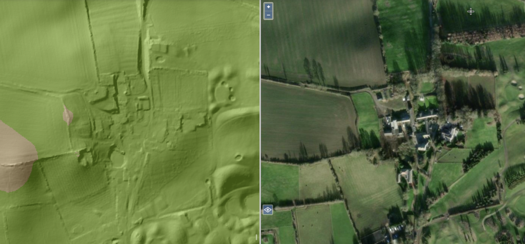
Hidden Medieval sites in Sunderland you cannot see with the naked eye, revealed here by LIDAR technology
LIDAR, Light Detection and Ranging, is a form of technology which uses lasers to map the precise dimensions of an area, completely revealing its size, shape and details going far beyond what the naked eye can see. Because of this LIDAR technology is used for geological and archaeological surveying of an area as it can reveal hidden or subtle things.
Let’s say we look upon an open space of land. While our view may be clear, we nonetheless cannot determine anything about the ground around us as it is obstructed by the presence of grass and perhaps trees too. What LIDAR technology allows us to do, however, is grant us a comprehensive and detailed depiction of the surface, showing us every little bump, nook and cranny.
This technology has allowed archaeologists to make outstanding discoveries. Just a few weeks ago, a group of Norwegian archaeologists used a LIDAR map to discover a shape in the earth which turned out to be a Viking longboat burial. LIDAR is subsequently revolutionising the use of archaeology.
Believe it or not, there is already a comprehensive LIDAR map resource available of England and Wales in their entirety, which has been coupled with Google maps allowing people to see every single aspect of the two countries in detail down to the street level, which of course includes Sunderland and the North East as well.
As a result, SGM decided to use the LIDAR map to explore Wearside and see if we could find any hidden historical details or clues not visible to the naked eye. While there are many famous medieval sites known in Sunderland such as Hylton Castle and St. Peter’s church, there are also more that can’t be seen. Here’s what we found.
Ridge & Furrow Medieval farms
In the Middle Ages, farming was arranged into a system known as “Ridge & Furrow” whereby as part of the cycle of crop rotation, the land was ploughed into deep ridge arrangements. These “scars” on the land are so deeply etched that they have persisted for hundreds for years, but are not visible to the naked eye due to having been grassed over. However, they are visible still through the use of LIDAR technology, which reveals these distinctive patterns. The same patterns are not visible for modern farms which are just presented as plain fields on the map, showing the difference in farming methods over time.
West Park, Herrington
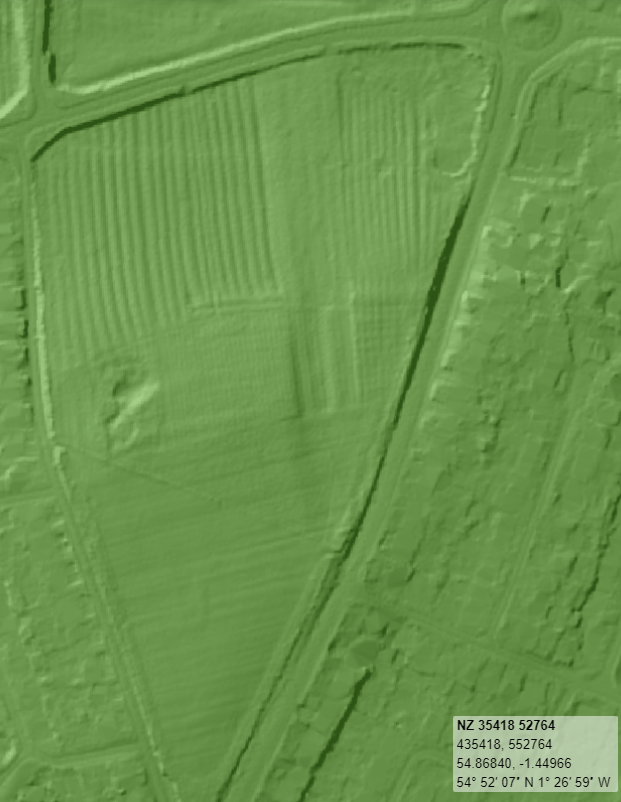
The first location Ridge & Furrow farming is visible in Sunderland is the area of West Park in Herrington. Long ago, this area used to be the central point or “village green” of the medieval township of Herrington, which existed independently as part of County Durham for centuries. Now, all that is left is a triangular stretch of land surrounded by housing estates. Here, the LIDAR shows a number of ridges have been carved into the field at the top side of the West Park.
Plains Farm and North Moor (Site under threat)
Another location a former Ridge & Furrow medieval farm exists is the patch of land between North Moor and Plains farm, behind where the former Farringdon Police station used to stand and McDonald’s. Again, the medieval ridges are clearly present on a lidar map. However, this site is under threat as there have been looming proposals by Gentoo to build houses on it.
Backhouse Park
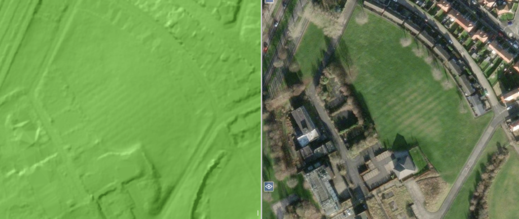
Another historic medieval Ridge & Furrow farm is located in what is now Backhouse Park, Hendon, on the banks of the Hendon Burn stream. For everyday onlookers, these ridges are concealed by the grass and trees, but are easily picked up by LIDAR. These ones have also been documented by archaeologists.
Hidden lost building, Ryhope
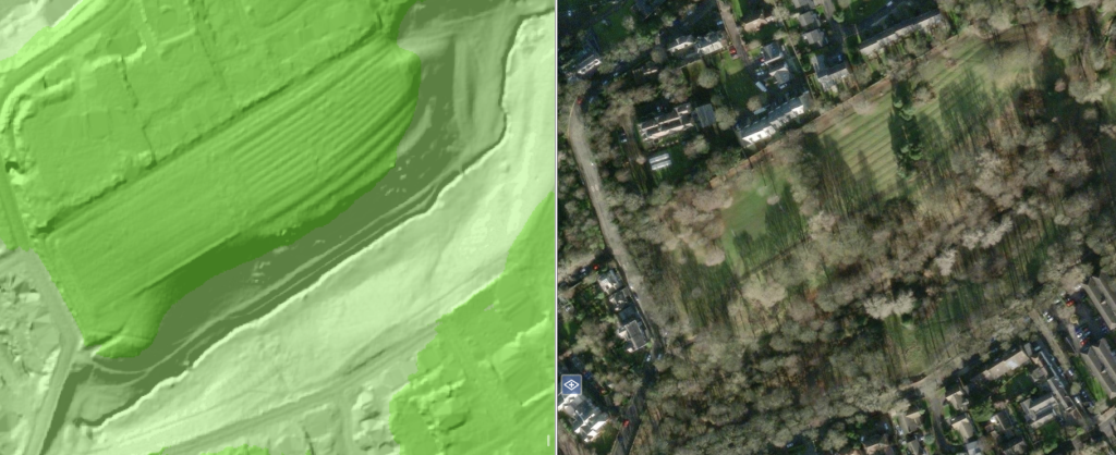
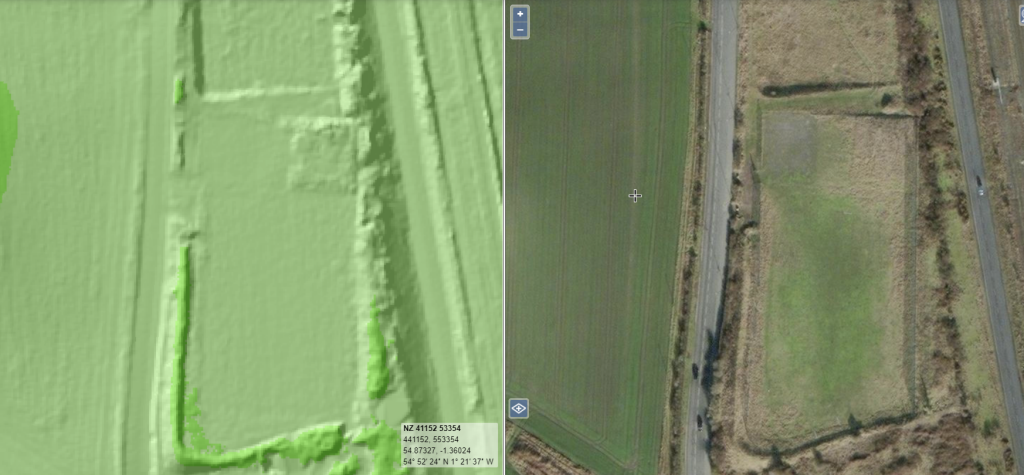
Using LIDAR technology you can determine the dimensions and presence of every single building. Although it is very, very difficult in an urban environment to decipher lost buildings due to the presence of existing ones, when you run it over various fields and open stretches of land it is possible to see the imprints and dimensions of buildings which previously existed. One such example is visible here in Ryhope next to the coastal road, where a conspicuous square shape exists in the middle of the field.
The Secret Garden, Doxford Park
Another Ridge & Furrow medieval farming arrangement is visible in the Secret Garden of Doxford Park. This is historically documented as the area was part of the traditional Silksworth township and estate. Although a pathway has been placed through it, the historical etches are still visible.
Barnes Park
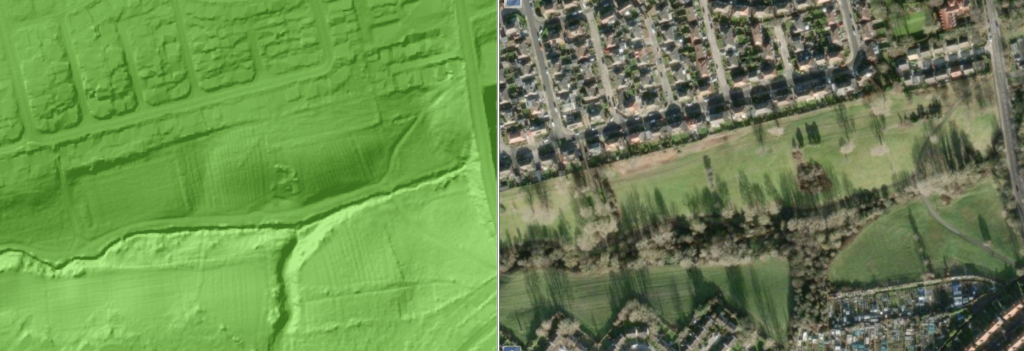
Barnes Park, which the Bishopwearmouth Burn flows through, was also occupied by Medieval farmsteads that have been built around the water source. Again, the Ridge & Furrow plow lines are visible. They cannot be seen by the naked eye. In the Middle Ages, Barnes Park belonged to now lost settlement known as the township of Hameldon (Humbledon).
The medieval village of Burdon
Burdon, which sits just outside of the A19, is a historical township of Bishopwearmouth that has existed since the Middle Ages. As a small agricultural village that has not been urbanised or built over, it is possible to see the the shadow of its Medieval past using LIDAR, which reveals the outlines of many former buildings and farming arrangements that the current settlement continues to sit within.