North East Guide: Salters Lane, the 1100 year old Mediaeval Road that spans from Sunderland to Wingate
If you want to visit the villages of East Durham, you can head down the A19 in a car and be there within the space of 20 minutes. One particular village, Wingate, is located 15 miles directly south of Sunderland just past Peterlee, but have you ever attempted the journey on foot?
There is an almost completely direct route intact starting at Warden Law that spans deep into County Durham that has existed since the early Middle Ages, long before the age of the A19. Its name? Salters Lane. The route strings together a group of villages, all which originated in the late Saxon era around the year 900AD and later on became mining communities. Following the lane allows the walker to explore the county’s mining heritage. In February 2024, this author walked down the Salter’s Lane Route on the first part of an excruciating two journey on foot into Yorkshire, across the Moors and into Helmsley.
Any small road that has existed since the early Middle Ages tends to bare the name “Lane”, which originated from the Old English word “Lanu” and thus used by the Anglo-Saxons. We should contrast this immediately with the word Street, which is a Latin word established by the Romans. A Lanu or Lane simply meant a passageway and this term was used for many Mediaeval roads, which were often based on very simple descriptions related to their purpose and geography that sound a bit eccentric.
For example, in Sunderland we can see this naming convention in places that have not changed shape since the Middle Ages, such as Crow Lane in Herrington, Crowtee Lane (upgraded to road), Paddock Lane in Tunstall, Stoney Lane in Southwick, Bodlewell Lane in the East End, and so on. Thus, as you go out of the core of Sunderland to the area of Warden Law, an area that has not been urbanised and therefore its road structure has been left unchanged, it is not surprising you find more of these ancient lanes. After leaving Burdon Lane south of Doxford Park, you enter Hangman’s Lane but as you follow that down, it soon transitions into the subject of this article, Salter’s Lane which heads all the way to Wingate.
The first segment of Salter’s Lane will take you to the village of Easington Lane. Here, part of the road has admittingly been cut away in order to make way for modern development, this change came presumably in the 20th century as old ONS maps from the 1850s continue to show the Salters Lane as one continuous route. As you follow it south you are subsequently interrupted by the B1285. Here, you turn right before turning left onto the deviation that was created at some point known as Murton Lane, which takes you into the centre of the Easington Lane village. You then follow the A182 (South Hetton Road), which runs through the middle of the village, southeast, before Salters Lane reappears after an Esso garage.
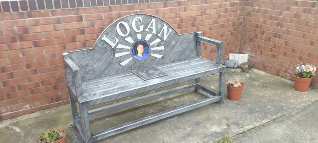
Once you’re back on Salters Lane the route will run continuously south all the way to Wingate, from one former colliery village to the next, becoming the “front street” of each respective settlement. Your first stop will be the village of Haswell. This is the smallest village you will encounter. On walking down the lane you will notice a bench mural dedicated to a young man who lost his life in a motorcycle accident, Logan. I contemplated in the article above how the village’s memory of this young man symbolised their sense of loss as a former coal mining community and the feeling of “solidarity” it brings.
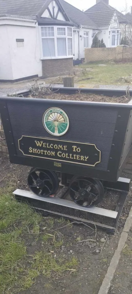
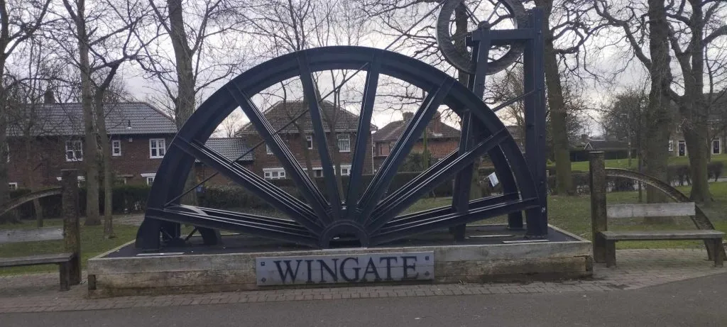
After Haswell comes Shotton Colliery, which is larger but as the entirety of the village is lopsided onto the left side of the road there isn’t much to see. Upon leaving Shotton, Salters Lane winds round what is now a forest before coming out into Wingate, which is the largest settlement on the route. Wingate has a giant colliery wheel sculpture commemorating its former mining heritage, as well as a variety of shops, pubs and restaurants.
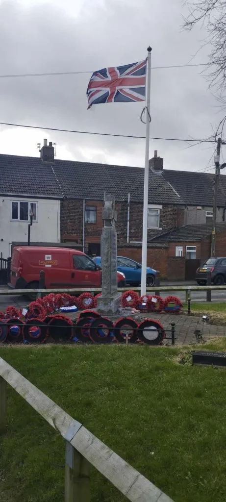
Again, the running theme that repeats itself is that Wingate has a very strong community with a sense of solidarity. These people dedicate themselves to uplifting each other with small, considerate and touching gestures, such as decorating Postboxes or taking great care of their village Cenotaph. After Wingate, the Salter’s Lane route continues onwards next to Station Town, but at this point the name “Salters Lane” disappears from maps altogether.
If you’re wondering where it goes, the road, now known as the B1280 ultimately spans Southeast through some fields before it finally merges into the A19 near Hartlepool, making the end of the Mediaeval route which linked multiple villages together for over 1000 years. It would be after Station Town that I subsequently left this route and joined the Huworth Burn Railway Footpath, a route which took me almost continuously all the way to Stockton-on-tees.