Wearhead: The Pennine village where the River Wear begins its journey eastward
The River Wear is the river which given life to Sunderland. As a crucial waterway into the North Sea, it enabled the transformation of our city from a series of small villages on its banks to an industrial giant through salt panning, coal mining and shipbuilding. Because of that, the river is an integral part of our local identity, hence the common name “Wearside“. But where does it begin? And at what point does the River Wear emerge?
The River Wear, flowing 40 miles (64km) eastwards, emerges in the Pennines on the Northwestern span of County Durham, near a tripart border to Northumberland and Cumbria in a small place called “Wearhead” which of course as a name is self-explanatory. The area which surrounds it is subsequently known as “Weardale” which
How do Rivers form? And what forms the River Wear?
A river is part of the hydrological cycle which describes the flow of rainwater from the sky, onto the ground and into the sea. A river after all, is a flow of water which increasingly gathers together from a broader area known as a “drainage basin” and subsequently becomes larger as it proceeds along its course. Naturally, because of gravity, rivers flow downhill and therefore they always emerge in areas of higher terrain where water concentrates at the top of mountains.
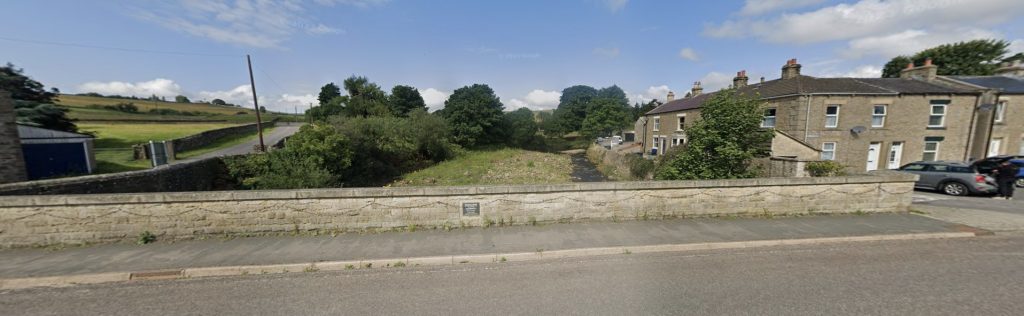
This helps us understand the formation of the River Wear. In the Pennines, water first gathers to form a number of smaller streams known as Burns. The primary burn behind the formation of the River Wear is known as Killhope Burn. As burn flows downhill it congregates together with other burns to ultimately form the River Wear, and the precise point this takes place at is subsequently known as Wearhead. Here, the burns accumulate under a Bridge on Front Street and formally become “The River Wear”, where its origin point is commemorated with a small plaque.
Wearhead is roughly an 1 hour and 12 minutes drive west from Sunderland, which can be reached almost directly from entering the A693 road past Washington and following it all the way along. Because it is so far inland and uphill, Wearhead for most of its history has been a small agricultural orientated settlement which has been isolated from the industrial heartland of County Durham to the East.
Although some iron and ore mining took place which paved the way for the historic Weardale Railway, known otherwise as the Stanhope and Tyne Railway, which spanned all the way to South Shields, this was gone by the 1960s. This seen the village decline in the latter half of the 20th century, before it eventually revived as a small tourist destination.